San Francisco’s Top Walking Trails: Rated by Distance and Difficulty
Whether you’re seeking a brisk urban stroll or a challenging climb, these Bay Area walking trails deliver on views, gradients, and accessibility.
Whether you’re seeking a brisk urban stroll or a challenging climb, these Bay Area walking trails deliver on views, gradients, and accessibility.
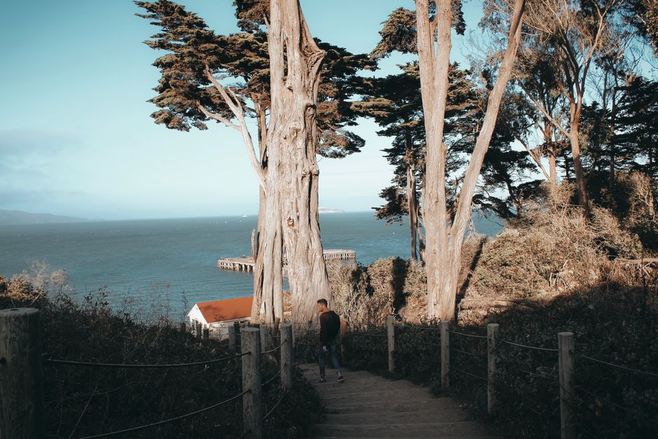
Fog City’s walkers are spoiled for choice, but the Lands End Trail has emerged as this summer’s most popular urban hike, according to recent attendance tallies from San Francisco Recreation and Parks Department. At 3.4 miles out and back, the cliffside path is drawing both casual strollers and seasoned trekkers—thanks in part to its blend of moody Cypress groves and Golden Gate Bridge vistas, and a moderate elevation gain of 538 feet.
Escaping the city’s streets for tree-lined trails is not just a pleasure—it’s a lifesaver during record-breaking heat. Heat advisories triggered on June 30 sent outdoor enthusiasts searching for shaded routes, particularly on the city’s western edge where coastal breezes dip temperatures an average of 4–7 degrees cooler than the downtown core. The city’s commitment to boosting public wellbeing by expanding trail access has made exploring local parks a year-round pursuit, but especially urgent during extreme weather and through the peak summer wellness season.
The Presidio’s Batteries to Bluffs Trail remains a classic challenge. Starting at Lincoln Boulevard, the 2-mile round-trip switchbacks wind through wildflower-strewn cliffs and descend sharply to Marshall’s Beach. Trail markers indicate a 420-foot elevation change—steep, but manageable in good shoes, and popular with serious walkers keen on heart-rate-raising climbs. On weekends, parking around Langdon Court fills up before 10 a.m.
Meanwhile, health clubs like UCSF’s Bakar Fitness & Recreation Center regularly organize guided walks along McLaren Park’s Philosopher’s Way, a 2.7-mile loop rated as easy to moderate, featuring art installations and cityscape views from Visitacion Avenue. Golden Gate Park’s Music Concourse paths, flatter and accessible, are favorites among seniors and those easing back into activity, with distance options from half a mile to three miles. The National Park Service maintains signage with accurate distances and QR codes for route maps throughout major trailheads.
San Francisco’s trail network has seen a notable surge in foot traffic—according to SFRPD’s annual report, weekday trail counts in June 2026 were up 17% from the previous year, with Lands End and Glen Canyon Park showing the sharpest increases. The city maintains over 50 miles of interconnected walking trails, many with new emergency call stations installed this spring, funded by a $1.3 million public safety grant. Trail maintenance crews began posting real-time alerts for closures and heat safety tips at prominent trailheads in May, after several hikers were treated for heat exhaustion last summer in Twin Peaks Park.
Parking is generally free at most city parks, but some, such as Twin Peaks, now charge a $5 fee for weekend access—part of a broader budget plan rolled out in April. Routine volunteer clean-ups, organized by Friends of the Urban Forest and local schools, keep paths clear of debris, especially after storms.
For first-timers, city health educators recommend starting with Golden Gate Park’s JFK Promenade, where the 1.7-mile flat route is accessible for wheelchairs and strollers. Trailheads are marked at Fulton Street and Stanyan. For those seeking steeper climbs, Bernal Heights Park’s 1-mile summit path features 360-degree views but a brisk 250-foot elevation gain—rewarding for the effort.
With forecasts predicting more heat spikes throughout July and August, plan outdoor walks for early mornings or late afternoons when temperatures dip. Bring at least 16 ounces of water and check the city’s online trail dashboard (sfrecpark.org/trails) for real-time route conditions and accessibility updates.
Sturdy walking shoes, sunscreen, and a charged phone are essentials—even urban trails can get unexpectedly slick or foggy. For advanced routes like Batteries to Bluffs and Glen Canyon’s steep paths, avoid solo hiking in low visibility hours and let someone know your plans. If aiming to join a group or guided walk, registration details and up-to-date calendars can be found via SF Rec and Park or UCSF Bakar Fitness Center. Next weekend’s Bay Trail Hike, hosted by SF Urban Walkers, starts at the Ferry Building and features guided options ranging from easy to strenuous, with advance tickets from $10–$25.
The good news: with dozens of distances and difficulty levels to choose from, every San Franciscan has a trail that matches their pace, ambition, and mood—no car required.
How does this story make you feel?
Spread the word
About this article
Published by The Daily San Francisco
Daily brief
Free, in your inbox before 7am. Weekdays.
More in Wellness